About Similan Islands
Established as a national park in 1982, Similan Islands are an archipelago of 11 islands in the Andaman Sea, 70 km off the coast in Phang Nga Province. The park covers an area of 140 km² of which 26 km² is land.
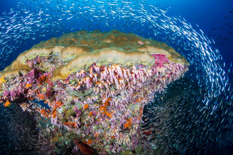
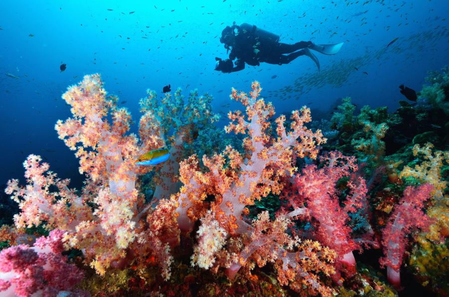
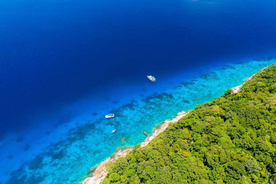
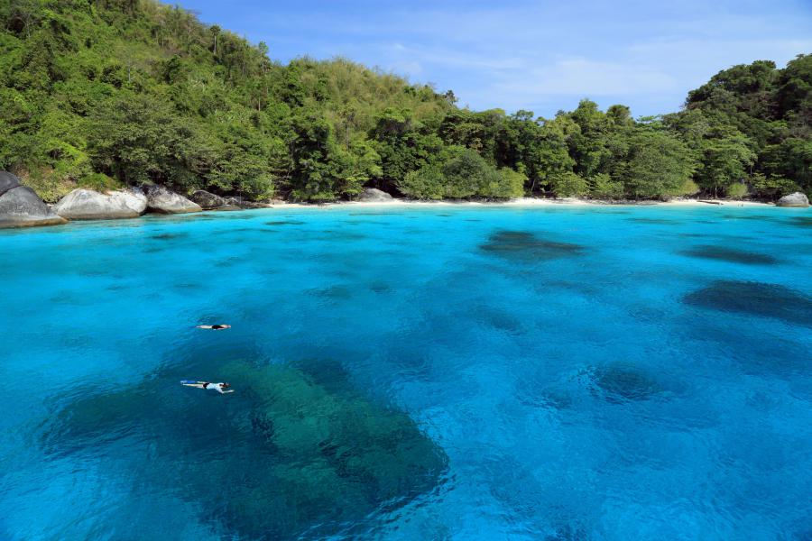
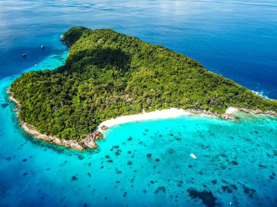
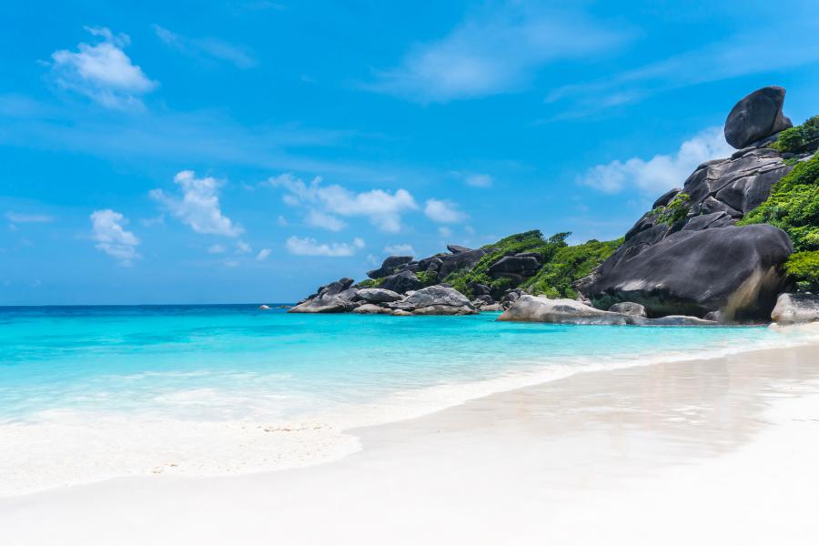
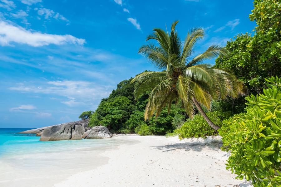
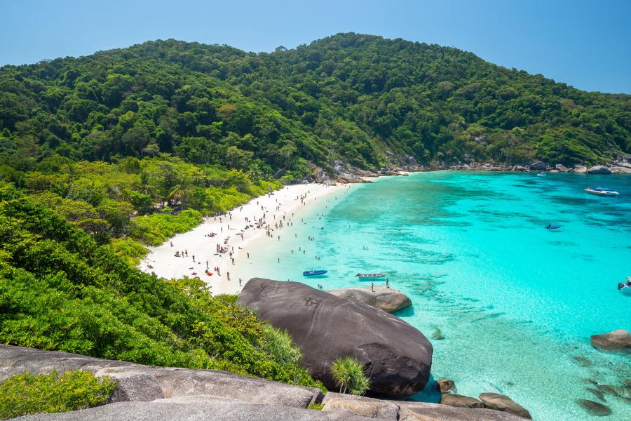
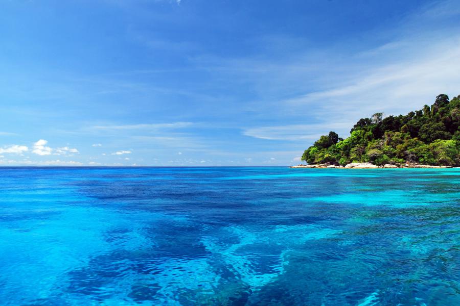
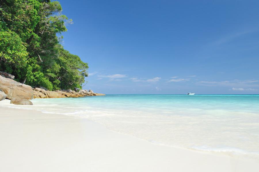
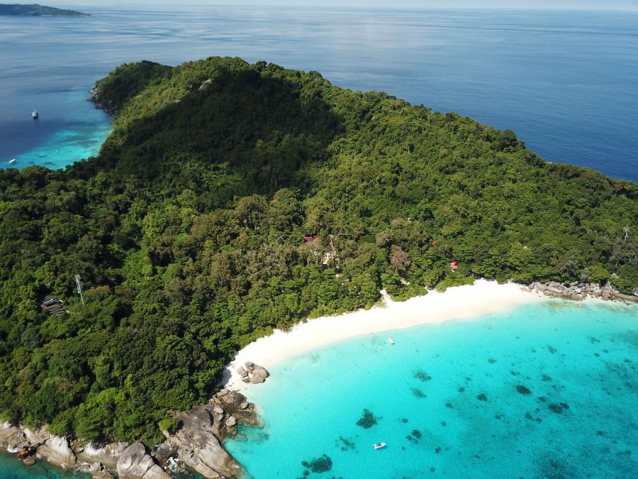
With a rich marine life consisting of hard and soft coral reefs, crystal clear waters and white beaches, Similan Islands are considered to be one of the best diving sites in the world. The main characteristics of the islands are the rock formations which consist of huge boulders, shallow waters and dense tropical forests.
Unfortunately, the islands are suffering from too many tourists. One of the worst affected islands, Ko Tachai has been permanently closed since 2016, as of 2021, still closed. Back in 2018 the problem with overcrowded visitors became so big that the park authorities limited the number of tourists to Similan Islands to 3,850 people a day, later further down to 3,325 people a day. Before the limitation, the islands were getting up to 7,000 visitors a day.
Various websites mention all possible spots around the national park as “uncharted”, “unexplored”, “secret spot” etc; there are no such places, all overcrowded any given day of the high seasons.
The nearest popular towns on the mainland are Khao Lak and Phuket, the nearest pier is Thap Lamu Pier south of Khao Lak.
The rainy season is from May to October with the most rainfall in June to September. The rest of the year is quite dry, very little rain from December to March.
Islands
"Similan" is a Yawi (a Malayan dialect) word which means nine. The park had originally nine islands numbered 1 to 9 but expanded to include two more remote islands back in 1998; Ko Tachai and Ko Bon. Although each island has a name they can be referred to with numbers.
The islands are; Ko Hu Yong (#1), Ko Payang (#2), Ko Payan (#3), Ko Miang (#4), Ko Ha (#5), Ko Payu (#6), Ko Hin Pousar (#7), Ko Similan (#8), Ko Bangu (#9), Ko Bon (#10, also known as Ko Talu), Ko Tachai (#11).
The two main islands are Ko Miang and Ko Similan.
Wildlife
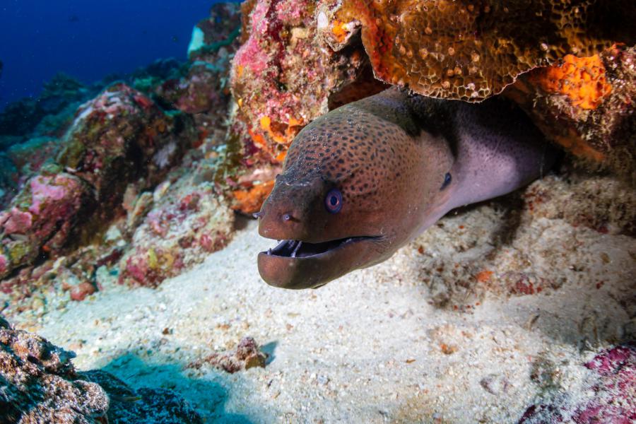
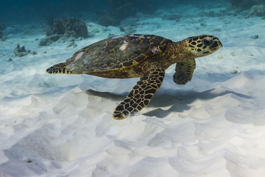
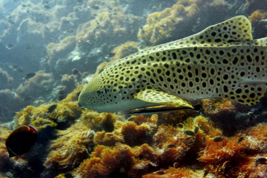
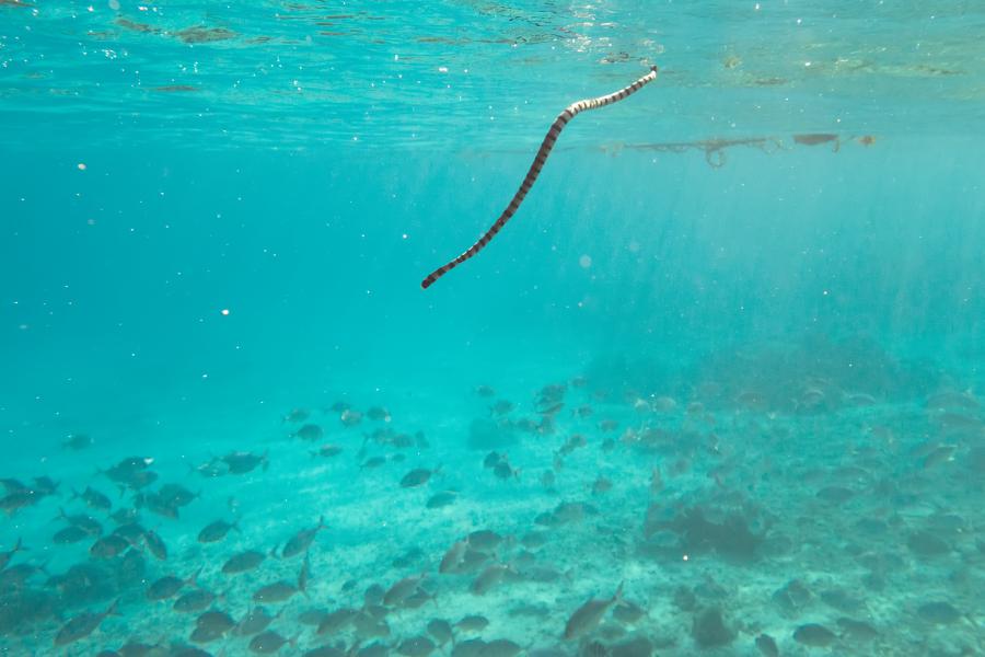
Most of the Southeast Asia’s impressive oceanic marine species can be found in Similan Islands; manta rays, whale sharks, whitetip reef sharks, blacktip reef sharks, leopard sharks, whale sharks, bluespotted ribbontail rays, spotted eagle rays, bowmouth guitarfish, shovelnose guitarfish, hawksbill sea turtles, olive ridley sea turtles, leatherback sea turtles, green sea turtles, giant morays, fimbriated morays, greyface moray eels, great barracudas, green humphead parrotfish, ribbon eels, giant trevallies, humphead wrasses and many more.
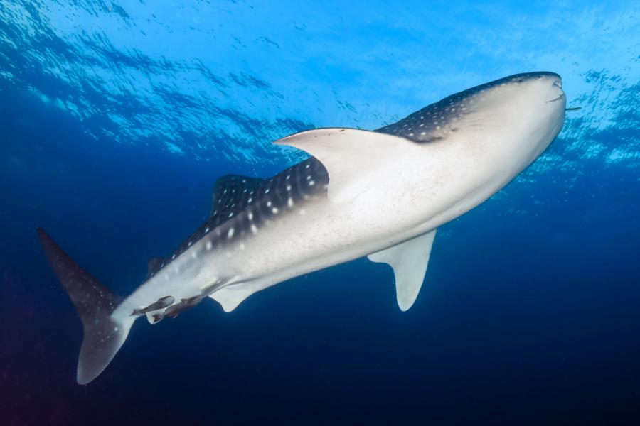
Whale sharks and manta rays are rare sightings, but they show up occasionally, typically around March-April.
So far less than 120 bird species have been reported from the islands. Parasitic jaegers, roseate terns, Nicobar pigeons and are some of the more rare birds in Thailand found in Similan Islands. Of the common birds barn swallows, greater coucals, common mynas, Pacific reef egrets, little egrets, pied imperial pigeons, white-bellied sea eagles and many others can be found in the islands.
Back in 1998 and 2010, 90% of the coral life in Surin and Similan islands died out followed by temperature changes. The 2010 event called Reverse Indian Ocean Dipole caused a natural "coral bleaching" that killed almost most of the marine life in the islands around. In August 2019, the park authorities announced that the corals are nearly fully recovered.
Visiting
Good to know that a maximum of 3,325 people are allowed to enter the national park every day. The ideal time to visit Similan Islands is during the winter and hot seasons from December to April when the waters are clear, making it the best time for scuba diving and snorkelling.
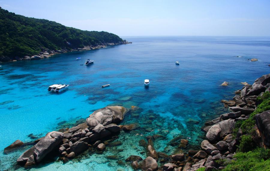
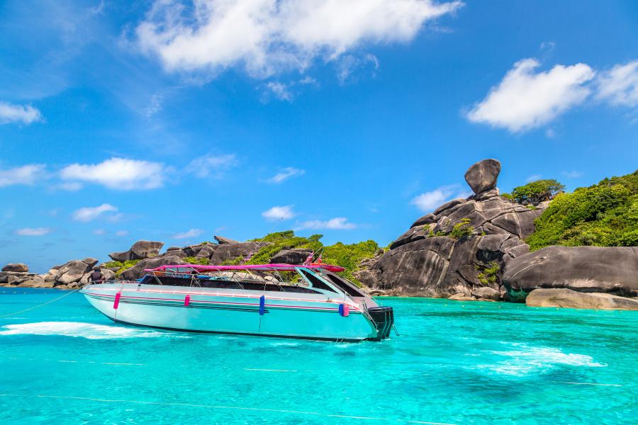
The islands can be visited with several different types of boats; Liveaboard dive boats are ideal for multiple days while day trip dive boats and snorkelling speed boats are for day trips.
Also called Khao Lak Pier, Thap Lamu Pier is the main pier for boats operating to the islands. The pier is 65 km from the main islands, 55 km from Ko Bon and 72 km from Ko Tachai. There are several other piers in the area, used by various tour operators that transport their customers from hotels.
Baan Nam Khem Pier is another option, about 22 km north of Khao Lak, mainly used to get to Ko Bon and Ko Thachai islands. It is about 52 km from Ko Bon, 55 km from Ko Tachai and 72 km from the original nine islands.
Mu Ko Similan National Park Office and the main visitor center are on the mainland near Thap Lamu Pier. There are also visitor centers in Ko Similan and Ko Miang Islands.
Getting to the nearest towns
There are three airports in the area; Phuket Airport is the nearest and the only international one about 70 km from the pier; it is also the most expensive option. Surat Thani Airport is the cheapest option about 175 km, Krabi Airport about 135 km from Lam Tapu Pier.
The nearest tourist destinations to Thap Lamu Pier are;
- Khao Lak, ~20 km and 30 minutes driving
- Khao Sok National Park headquarters, ~78 km and 1.5 hours driving
- Phuket, ~105 km and 2 to 2.5 hours driving
- Khura Buri (to Surin Islands), ~105 km and 1h 50 minutes driving
- Krabi & Ao Nang, ~135 km and 2 hours 15 mins driving
- Surat Thani, ~195 km and 3 hours driving
There are regular coach routes from Bangkok or Hua Hin to Phuket or most other towns in the area. All buses to Phuket from Bangkok drive through Khao Lak along the west coast.
Surat Thani City 200 km east is a cheap option to get to with domestic flights or by train from Bangkok. It is also the nearest city to the popular tourist destination of Ko Samui. It is very easy to get into a minivan/bus from Surat Thani to Khao Lak.
Getting to Thap Lamu Pier or Khao Lak
The pier name is spelled in various ways; Thap Lamu Pier, Tab Lamu Pier, Tap Lamu Pier, Thaplamu Pier etc. The correct spelling is Thap Lamu Pier.
The pier is about 20 km south from Khao Lak and 5.5 km from Highway 4 and can easily be reached by various public transportation options or taxi from nearby towns and airports. It is signposted as “Similan Islands” from the highway.
Minivans are the most practical and common transportation between nearby towns, coach buses are more for long distance trips. While the buses drop the passengers on the main road, the minivans drive all the way to the pier when asked.
The staff at various hotels in Khao Lak, Krabi, Phuket and other nearby towns normally help by calling minivan operators which come and pick hotel guests from the hotels, quite hassle-free. If hotel staff can’t help, they can give advice about the nearest agency to make arrangements from or give the directions to the minivan stations.
Khao Lak is easily accessible by public transportation options from all major tourist towns in the area. All buses or minivans operating from Bangkok, Hua Hin or Chumphon to Phuket will drive through Khao Lak. There are also regular minivan services from Krabi and Surat Thani.
When driving from Phuket; drive north along highway 402 which will join and follow Highway 4 further north, drive until a big blue signpost showing the directions to left to “Similan Islands”.
When driving from Khao Lak; drive south along Highway 4 for about 25 minutes until the big blue signpost showing the direction to the right.
When driving from Krabi; follow the Highway 4, turn to route 4090 and driver about 14 km, turn left to 4240 and drive about 17 km until the road reached Highway 4 along the west coast, turn right to Highway 4 and drive north another 12 km until the big blue signpost showing the direction to “Similan Islands” to the left.
Booking boats/tours
It is more practical to get to the islands by booking a tour that includes transportation from the hotel and later drop off at the hotel after the tour ends.
Most resorts from nearby towns or agencies can help to arrange boat trips. In hotel lobbies there are always tour folders laying around, offering tours to various places, including to Similan Islands. It is also possible to book trips online via various websites.
Entrance fees & opening times
The entrance fees for the Similan Islands are 500 Baht for adults and 250 Baht for children aged 3–14 years. Thai nationals pay 100 Baht for adults and 50 Baht for children.
The national park is open to visitors from 15 October to 15 May each year and remains closed during the southwest monsoon season. In years with particularly poor weather conditions, the park may close earlier than 15 May. Any early closure announcements will be published on this page as soon as they are confirmed.
Daily visiting hours are from 8:00 am to 4:00 pm. Visitors may not arrive at the islands before 8:00 am and must depart by 4:00 pm at the latest. As a result, tour boats often leave mainland piers well before 8:00 am to ensure arrival shortly after the park opens.
All information on this page was last updated in June 2026. The opening dates, visiting hours, and entrance fees have been verified directly with the national park authorities.
Mobile reception
Mobile reception is limited to the following providers only; AIS, TrueMove and DTAC.
Activities
Diving and snorkelling are the main activities in Similan Islands. The best time for diving is around December to April when wind is minimal and the average water temperature is around 29 °C. February to April is the most ideal time to spot large pelagic species like manta rays and whale sharks, but sightings are rare.
There are many beaches on various islands where it is possible to relax and swim, some islands have trails into the island or to viewpoints.
The islands are perhaps not a popular birding destination, but there are few migratory birds visiting the islands, not found elsewhere in the country. Wildlife watching possibilities in Similan Islands are limited.
Stay & eat
There are plenty of resorts in Khao Lak which is the nearest popular tourist town.
There used to be a campsite in the islands but camping is not possible anymore, this to limit the number of visitors. There are also no park accommodations in the islands.
There is only one restaurant in the islands; it is in Ko Miang, open from 8 am until 2 pm daily.
Phone(s)
You are recommended to ask a Thai speaking person to call on your behalf.
There are English speaking staffs to answer the phones but the English level is basic.
+66 (0)76 453 272
Attractions of Similan Islands
Ko Huyong
(Island #1) It is the southernmost island with a water depth of 10-15 meters around the island. It has the longest white beach in the national park which also is a nesting place for sea turtles. Apart from swimming, the island is ideal for scuba diving.
Coral Gardens
Located at the east side of Ko Huyong, it is an ideal place for snorkelling and scuba diving. The coral life here is very rich, the max depth is 39 meters with 20 to 40 meters visibility and low/medium currents.
Ko Payang
(Island #2) Ko Payang is a small island with rocky hills and rock formations, ideal for snorkelling and scuba diving.
Ko Payan
(Island #3), Located northwest from Ko Payant, it is a small island with rocky hills and rock formations, ideal for scuba diving.
Sharkfin Reef
The reef is located southeast of Ko Payan, consists mainly of submerged massive granite boulders covered by gorgonian sea fans and various hard corals. The max depth is 40 meters with an average depth of 18 meters, low current and clear visibility down to 30 meters.
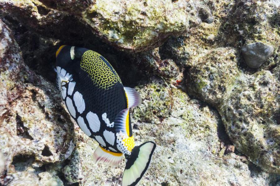
Stingrays, humphead wrasses, clown triggerfish, schools of bait fish, halfmoon triggerfish, palette surgeonfish, blueface angelfish, schooling bannerfish are some of the species found in the reef. Some shark species seen are whitetip reef sharks, blacktip reef sharks and leopard sharks.
The reef also has a large swim-through worth exploring.
Boulder City
Located 400 meters further southeast from Sharkfin Reef, it consists of three submerged granite pinnacles surrounded by smaller boulders. The sea surface is flat and sandy with scattered boulders covered with coral in few places, algae growth is common. Depth is 12 to 30 meters with good visibility. Currents can be moderate or strong which makes the diving more suitable for the experienced divers.
Dogtooth tuna, great barracuda, Indian mackerel, clearfin lionfish, tassled scorpionfish and moray eels are common in the reef. Leopard sharks and whitetip reef sharks are seen in deeper waters; bigger species like manta rays and whale sharks may be seen passing by but are rare.
Ko Miang
(Island #4), Ko Miang is the second largest island in the national park where the only restaurant of the island and one of the visitor centers is found. There are two beautiful white beaches on this island 20 minutes walking distance from each other.
The island offers many activities like swimming, scuba diving, snorkelling, trekking and a bit of wildlife watching possibilities.
Bird Rock
Also called Chinese Wall, it is located on the south edge of Ko Miang, it consists of large granite boulder formations creating a wall stretching south and a bay on the east side. The rock formations have many canyons, swim throughs, tunnels and underwater caves. This site has some soft and hard corals on the west side.
The depth is around 5 to 30 meters with 15 to 40 meters visibility; current is often mild but may occasionally be strong, suitable more for experienced divers.
The coral gardens on the west side have a depth of 10 to 15 meters with around 20 meters visibility, good for snorkelling but snorkelers are advised to stay in the bay close to the island due to risk for strong currents.
Moray eels, parrotfish, trevallies, sweetlips, fusiliers, humpnose unicorns, clown triggerfish are some species seen in this site. While whitetip reef shark juveniles are quite common, leopard sharks may occasionally be seen.
Bird Rock is one of the less visited spots in Similan Islands; it is a good location for divers who want to enjoy diving in peace.
Ko Ha & Ko Hok
Ko Ha and Ko Hok are two smaller island numbered #5 and #6, on the east side of Ko Miang, possibly the best snorkelling and diving location in the park. It consists of hard and soft corals with a very rich sea life.
Anita's Reef
Also known as Barracuda's Point or Hin Muan, the reef is situated on the east side of Ko Ha and Ko Hok. The reef consists of a mixture of scattered boulders, large sandy seabed and staghorn corals. It is one of the most popular dive sites for both beginners and experienced, suitable for night diving as well. The average depth of the site is 12 to 40 meters with 10 to 30 meters visibility. Currents are very mild and don’t happen often.
Species found in the reef are endless; glassfish, bluespotted ribbontail ray, spotted garden eel are just a few to mention.
Ko Bayu
Island #7, a mid-size island located north of Ko Miang.
East of Eden
Also called "The Orchid Garden", no doubt one of the best diving sites in Thailand. Starting at shallows of 6 meters, the reef steeply reaches the depths of 35 meters with an average depth of 20 meters. The visibility is about 10 to 30 meters, the currents are medium.
The site is ideal for snorkelers and all levels of scuba divers, for night diving too. The Orchid Garden is in between 12 to 25 meters depth, covered with soft corals like staghorn, table, pore corals, orange/red gorgonian sea fans, anemones and colorful feather star worms.
Hawksbill sea turtle, green sea turtle, ribbon eel, blue ring angelfish, blueface angelfish, halfmoon triggerfish, clown triggerfish, false pipefish, giant moray, yellow longnose butterflyfish, royal angelfish, potato cod, ornate ghost pipefish are few of the many interesting species found in the reef. The deeper end of the reef is sandy sea bed, home to bluespotted ribbontail ray, spotted garden eel, blacktip reef shark and leopard sharks. Larger sharks may be seen passing by.
West of Eden
Located on the west side of Ko Bayu, it consists of large boulders covered with gorgonian sea fans, anemones, feather stars and hard/soft corals, some canyons and sandy seabed. Shallow waters are ideal for less experienced divers.
The depth is 12 to 35 meters with 20 to 25 meters visibility, the currents are medium.
Green sea turtle, hawksbill sea turtle, redtoothed triggerfish, red fire gobies, blacktip reef sharks and whitetip reef sharks at lower depths are few species seen around.
Deep Six
Located at the northern tip of Ko Bayu, it is a v-shaped ridge that starts 5 meters below the sea surface as an extension of the island. As the name suggests it is a deeper site, suitable both for intermediate and experienced divers.
The site consists of a pinnacle that rises right above the sea surface, a stunning cluster of submerged boulders, canyons, tunnels, swim throughs between large granite boulders that gradually steps down deeper.
Giant barrel sponges, big sea fans, feather stars are common and corals include small table, green tree, wire, wart finger and leather corals.
The depth is 5 to 40 meters with an average of 20 meters depth, 10 to 30 meters visibility and moderate to strong current. It is suitable for experienced divers.
Frogfish, streaked spinefoot, clearfin lionfish, tassled scorpionfish, bluespotted ribbontail ray, dogtooth tuna, giant trevally, moray eel, lobster, shrimp, hawksbill sea turtle, nudibranch are some of the many exciting species found in this dive site. Occasionally manta rays, whitetip reef sharks seen in deeper end at 30+ meters.
Ko Similan
Island #8; It is the largest island in the national park with an average depth of 25 meters around the island. It has a small bay on the western side. The island is ideal for hiking, scuba diving, snorkelling and swimming.
There is also a rock formation which is a smaller viewpoint with a good view over the sea.
Fantasea Reef
Located a bit offshore on the west coast of Ko Similan, it is considered to be one of the best diving sites of the archipelago. The reef has wonderful underwater granite boulder formations spread over a huge area with a great variety of marine life.
Elephant Head Rock
Locally known as Hin Pousar, Elephant Head Rock is an unusually shaped rock situated southwest of Koh Similan ideal for diving only. The dive site is a bit more challenging compared to other sites in the islands due to surge and strong currents that may happen.
The dive site offers swim throughs, underwater tunnels and hide-outs for fish. Species found in these waters are large snappers, clearfin lionfish, olive ridley sea turtle, hawksbill sea turtle, spider crab, blue ring angelfish, leopard shark and McCosker's flasher.
The southern side of the deep waters consists of submerged pinnacles where whitetip reef sharks may be seen.
Beacon Point
Named after the beacon at the southernmost of the Similan Island, it is a more challenging dive site. The depth is 10 to 37 meters with an average depth of 20 meters, 10 to 30 meters visibility and with strong currents.
The southern part of the site is normally the starting point which consists of large granite boulder formations covered with hard corals, gorgonian sea fans, sandy seabed and swim throughs. The dive route continues eastwards and ends at the Beacon Reef. Nearly 2 meter wide gorgonian sea fans seen here are the largest ones in the national park.
The species seen here are similar to ones in Beacon Reef, but Beacon Point gives better opportunities to spot sharks and rays due to depth. Some of the sharks seen here are; whitetip reef sharks, leopard sharks, zebra shark and occasional blacktip reef sharks.
Donald Duck Bay
Ko Ba-Ngu
(Island #9) It is the northernmost of the original 9 islands, ideal for scuba diving at the northern side with a depth of 10 to 35 meters.
Breakfast Bend
Breakfast Bend is located on the east end of Ko Ba-Ngu. Being one of the best dive sites in the national park, the name refers to the early morning diving in the beautiful morning sun. Diving is ideal for experienced divers as well as for beginners and snorkelers.
The reef consists of scattered boulders on a sandy seabed and rocky slopes with large boulders in deeper points, very rich in coral life. With staghorn corals being the dominant species, cabbage corals, brain corals, table corals and plate corals are few of many corals that cover the sea bed. The maximum depth is around 35 to 40 meters with an average depth of 18 meters, 10 to 30 meters visibility and low/medium currents.
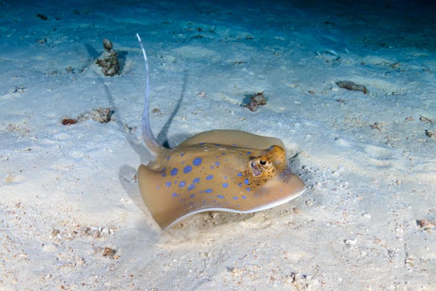
While yellowtail barracudas, ghost pipefishes, spotted garden eels, blue ring angelfish, milkfishes, green sea turtle, hawksbill sea turtle are quite common in the reef it is less common with larger pelagics. The biggest common species seen in the reef are Whitetip reef shark, leopard shark, zebra shark and bluespotted ribbontail rays, these can be seen resting on sandy seabeds.
Christmas Point
Situated on the northwest ridge of Ko Ba-Ngu, it is a cluster of submerged boulders and pinnacles with exciting underwater tunnels formed by large rock formations. Its soft and hard corals combined with rock formations are scenic, considered to be one of the best diving spots in the national park. Diving depths range from 10 to 40 meters with 20-30 meters visibility.
Some exciting species found in these waters are whitetip reef sharks, humphead wrasse, ribbon eels, trevallies, turtles and great barracudas.
Ko Tachai
Ko Tachai is a small island with a 800 meters long beautiful white sandy beach and few great diving spots. It is located between Surin Island and the original 9 islands of Similan Islands, about 47 km north from Ko Similan, 26 km north from Ko Bon and 32 km south from Surin Islands.
While Ko Tachai Island has been permanently closed to the public since 2016 (as of 2020, still closed), some of the dive sites around the island are still open for divers. Before the closure, there was a camping ground next to the beach where visitors were allowed to camp, there were also restaurant, toilet and bathroom facilities.
There are two short trails starting from the beach on the east side of the island. One is about 500 meters long, starts from the southern end of the beach and continues a bit into the forest. The second trail is 700 meters long, starts from the northern end of the beach and ends at a viewpoint on the rocky end east of the island.
There are several diving spots around the island of which Tachai Pinnacle is no doubt the most exciting one. The other dive sites are three reefs with a maximum of 20 meters depth each.
There are several piers to get to Ko Tachai from; Baan Nam Khem Pier (55 km), Lang Thung Pier (aka Khura Buri Pier, 66 km) and Thap Lamu Pier (71 km).
Tachai Pinnacle
Also referred to as Twin Peaks, it is located around 400 meters south of the island, it is a submerged reef consisting of boulders and sandy sea bed is no doubt one of the top diving sites in Thailand. The top of this pinnacle is 12 meters below the surface, dome shaped and covered in hard corals. It descends down to around 35 meters. The rocks are covered with large sea fans, anemones and crinoids and have some nice swim-throughs between.
Manta rays, whale sharks, sea turtles and most other marine species found in the national national park are also found around the pinnacle. Larger schools of fishes like giant trevallies, bluefin trevallies, great barracudas, dogtooth tunas and many others are frequently seen hunting around the pinnacles.
Currents are generally very strong and can be challenging around the pinnacle, diving suited for professionals only. To avoid strong currents, there is a support line from a mooring buoy the divers can descend with. Visibility is around 20 to 30 meters, occasionally dropping to less than 10 meters.
Although the name may refer to a single pinnacle, there is a second smaller pinnacle in the immediate vicinity of the main pinnacle.
Ko Bon
Also known as Ko Talu by locals, Ko Bon Island is one of the smaller islands, about 23 km from the northernmost edge of the original nine islands in the national park. It is a rocky island along the coast and covered with a small forest.
The island is popular for its many underwater stone pinnacles, due to strong currents ideal for experienced divers only. There are several diving spots on the west, northwest and north of the island. The two main diving spots are not ideal for snorkelling as most of the beauty is hidden deeper down, not visible from the surface. It is possible to snorkel in the shallow bay on the west side.
Leopard sharks are quite common around the island, pretty much most other exciting species seen elsewhere in the national park can also be seen around Ko Bon. It is one of the best spots in the region to see manta rays, best time around April to May.
There are two piers to get to Ko Bon from; The most used pier is Thap Lamu Pier (55 km) and Baan Nam Khem Pier (52 km).
There are no accommodations in Ko Bon. The island can only be reached by day trip from other islands in the park or from the piers.
This island is not to be confused with another popular island with the same name just 2 km off the coast from Phuket Island.
Ko Bon West Ridge
A rugged underwater ridge on the west side of the island. The ridge drops down to 35 meters with an average depth of 15 meters, extending for about 100 meters out to the deeper waters.
Ko Bon Pinnacle
Locally known as Hin Luang (meaning yellow rock) but also referred as Pinnacles, located not too far north from the West Ridge, it consists of four pinnacles that drop from 18 meters below the surface down to 40 meters. The pinnacles raise up to 22 meters tall. As the Thai name suggests, the corals are covered in yellow soft corals but also sea fans.