About Phu Hin Rong Kla
Situated mainly in Phitsanulok Province nearly 130 km from Phitsanulok city center, this 307 km² mountainous park extends east into Loei and Phetchabun provinces nearly 40 km from the Laotian border.
Due to its rugged terrain and strategic location, the park was an ideal place for guerrilla warfare and became a stronghold for Communist Party of Thailand (CPT) back in the 70's. The remains of their camps and hides are one of the main attractions of the park. Phu Hin Rong Kla was declared as a national park in 1984, only two years after the defeat of the insurgents.
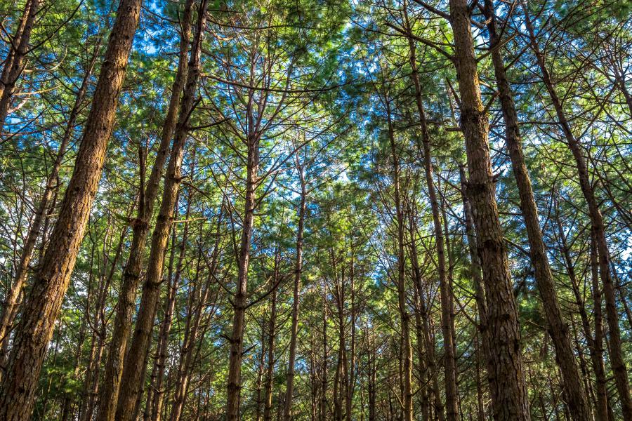
The 1,794 meters tall Phu Thap Buek is the highest mountain in the park in Loei Province. The mountain range is part of the Luang Prabang montane rainforest ecoregion that extends 280 km north along the Thai/Laos border to Luang Prabang in Laos.
Wildlife
Most of the larger mammals in the park got extirpated during the war between the government and the communists. Although it is believed that few tigers still roam in the park, there is no evidence. The size of the park is simply not enough to hold a tiger population; there are also no immediate adjacent protected areas any eventual tigers may move between. Some rare sightings in the park are leopards (Panthera pardus), leopard cat, Asian black bear, Asian golden cat, hog badgers, Indochinese serows and barking deer (Muntiacus muntjak).
Over 200 bird species have been reported from the park. Some of the birds found in the park are; Nepal house martins (Delichon nipalense), northern house martins (Delichon urbicum), rusty-cheeked scimitar babblers (Erythrogenys erythrogenys), Siamese firebacks (Lophura diardi), grey peacock-pheasants (Polyplectron bicalcaratum), Hodgson's frogmouths (Batrachostomus hodgsoni), rusty-naped pittas (Hydrornis oatesi), black-eared shrike-babblers (Pteruthius melanotis), eyebrowed wren-babblers (Napothera epilepidota), chestnut-eared buntings (Emberiza fucata), white-gorgeted flycatchers (Anthipes monileger), pygmy cupwings (Pnoepyga pusilla), slaty-bellied tesias (Tesia olivea), rufous-winged fulvettas (Schoeniparus castaneceps), white-headed bulbuls (Hypsipetes thompsoni), striated bulbuls (Alcurus striatus), dark-backed sibias (Malacias melanoleucus), lesser shortwings (Brachypteryx leucophris) and Jerdon's bushchats (Saxicola jerdoni).
Visiting
Besides the historic sites, the park is home to several impressive viewpoints and waterfalls, the park is also famous for its flowers and lush forests. One of the most characteristic attractions of the park is the strange rock formations in Lan Hin Taek area some 400 meters west from HQ. Most of the park's attractions are easily accessible from the 37 km long road between western and eastern checkpoints.
Get there
There are no public transportation options driving through the national park. The only options to get to the park are private arrangements, either a car or a guided tour.
Get there from Phetchabun - Follow Highway 21 north from Phetchabun for 40 km until the end of the highway on a T-junction and turn left to Highway 12. After about 5 km, turn right to Road 2372, for this route north about 16 km, a big sign will show the way left up to “Phu Hin Rong Kla” and “Phu Thap Buek” mountain. Turn left and follow the road until you reach the park entrance. This road is very uphill, if you intend to drive up with a sedan, good to stop by from time to time and let the engine cool down. Also good to check the water levels in the car. Too many cars seen on the way uphill, giving up often steam coming out from front. It is a tough road for many cars.
Get there from Phitsanulok - Follow Highway 12 east from the city center for about 68 km until seeing a sign showing the way to Nakhon Thai north on Road 2013 north (turn left). Follow this road for about 24 km until you see a big blue signpost pointing the way right to “Phu Hin Rong Kla”, confusingly enough, the road to the right is also numbered Road 2013. Follow the road for another 5.4 km until another sign showing right to Phu Hin Rong Kla. Turn right and follow the road until reaching a checkpoint.
Entrance fees & opening times
As of June 2022, the entrance fees are 200 Baht for adults and 100 Baht for children 3-14 years old. Thai citizens pay 40 Baht for adults and 20 Baht for children. Cars charged 30 Baht.
Phu Hin Rong Kla National Park visitor center is open 8 am until 4:30 pm every day, but it is possible to enter the park and camping ground 24 hours a day.
Stay & eat
Park accommodations
The price for the park accommodations range from 800 Baht per night (2-3 people) up to 6,000 Baht per night (30 people), a significant discount will apply when booked for Mon-Thu. All accommodations are equipped with a water heater for showers.
The park accommodations can be booked through the DNP website in advance or on spot from the visitor center if there are any available. As the money transfer must be done within 2 days and the fact it takes a longer time with transfers from abroad, it is only possible to book from within Thailand only. Payments can be done at 7-Eleven convenience stores or banks.
Camping
It is possible to set up a tent at the camping ground not too far from the visitor center. There are tents available for rent from the visitor center. Tents for 2-3 pax cost 225 Baht per night, additional sleeping sets including a sleeping bag, a pillow and a mat costs 60 Baht per person.
There are several toilet and bathroom facilities spread out all over the huge camping group.
Eat
There are two restaurants in the vicinity of the visitor center in a short stroll from the park accommodations and the campsite. They are normally open from 7 am till about 8 pm, the opening/closure times may be different on less busier days.
Phone(s)
You are recommended to ask a Thai speaking person to call on your behalf.
- 081 596 5977 - Visitor Center
Attractions of Phu Hin Rong Kla
Visitor Center & headquarters area
The visitor center is reached by Highway 2331 that runs through the park. The area has a smaller museum showcasing some artefacts from the CPT era, exhibiting items like medical instruments, Chinese anatomy charts, paintings of Mao Tse Tung and Joseph Stalin.
The camping ground and park accommodations are located a few hundred meters from the visitor center. There are tents/sleeping bags and other accessories available for rent from the visitor center.
While Lan Hin Teak viewpoint is within walking distance from the visitor center area, Lan Hin Pum is a few kilometers away, better to get there by car.
Insurgent headquarters
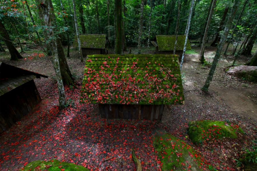
Accessible by a 3.5 km long trail starting near the museum, this place was used as headquarters by communist insurgents to carry out their administrative functions. Interesting to see here is the meeting place, jail and intelligence center, wooden huts and a water wheel. There is a cafeteria and cloth shop in the vicinity.
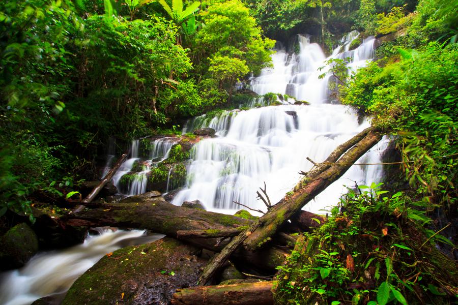
Waterfalls
There are few waterfalls in the park, most of them relatively easily accessible with short trails, some requiring up to 4-5 km of hiking.
Romklao and Paradon Waterfalls
Both waterfalls are accessible by a nearly 1 km long trail starting 5 km from the park's headquarters. The trailhead is before the School of Military Politics on the left side. A second side trail downstream from Romklao Waterfall leads to Paradon Waterfall. (The location of this waterfall shown on the map is not accurate, the trail head is correct)
Man Daeng Waterfall
Situated nearly 22 km southeast from the headquarters, this 32 tiered waterfall is accessible by a 3.5 km long trail starting from the waterfall visitor center on the main road. Park staff guidance required to walk this trail.
Sri Pachrin waterfall
A medium-sized waterfall accessible by a 600 meters long trail off the road near Huay Namsai village.
Ganglad and Tadfa Waterfalls
Ganglad Waterfall is a small waterfall accessible by a 2 km dirt road from Huay Namsai village outside the western checkpoint, down at the foothills of Phu Hin Rong Kla. The more impressive Tad Fa Waterfall (also known as Tan Gawsahng) is accessible by a trail 3 to 4 km further uphill.
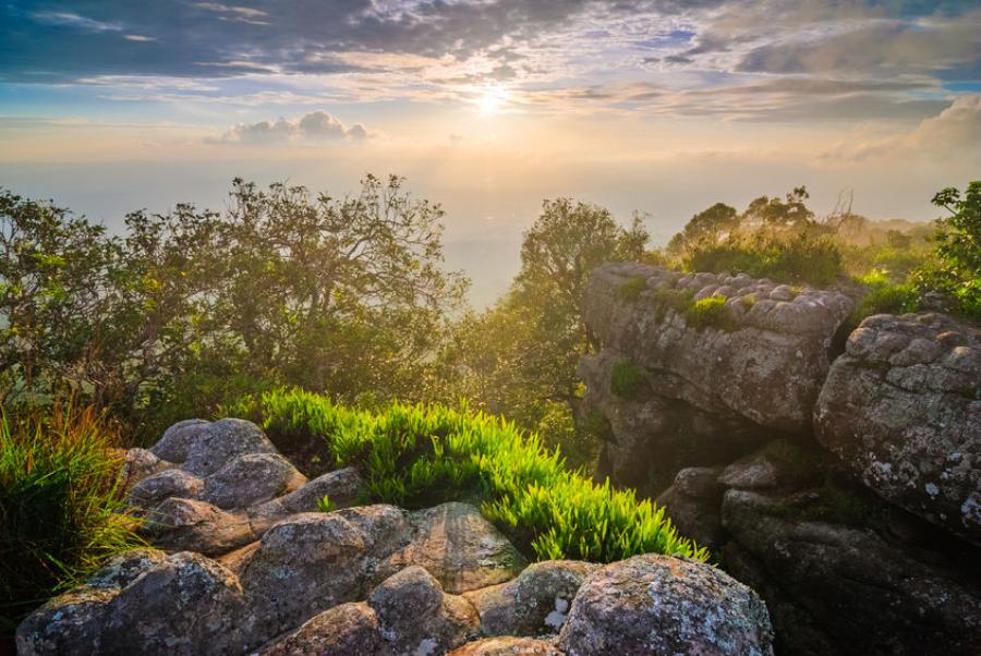
Viewpoints
The park has a number of impressive viewpoints, some along the roads, others accessible by relatively short stroll.
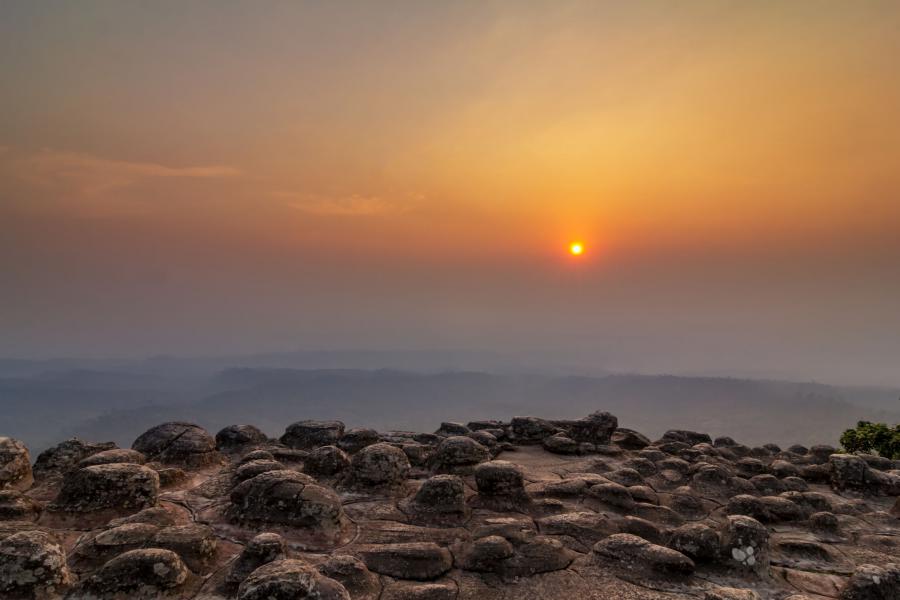
Laan Hin Pum Viewpoints
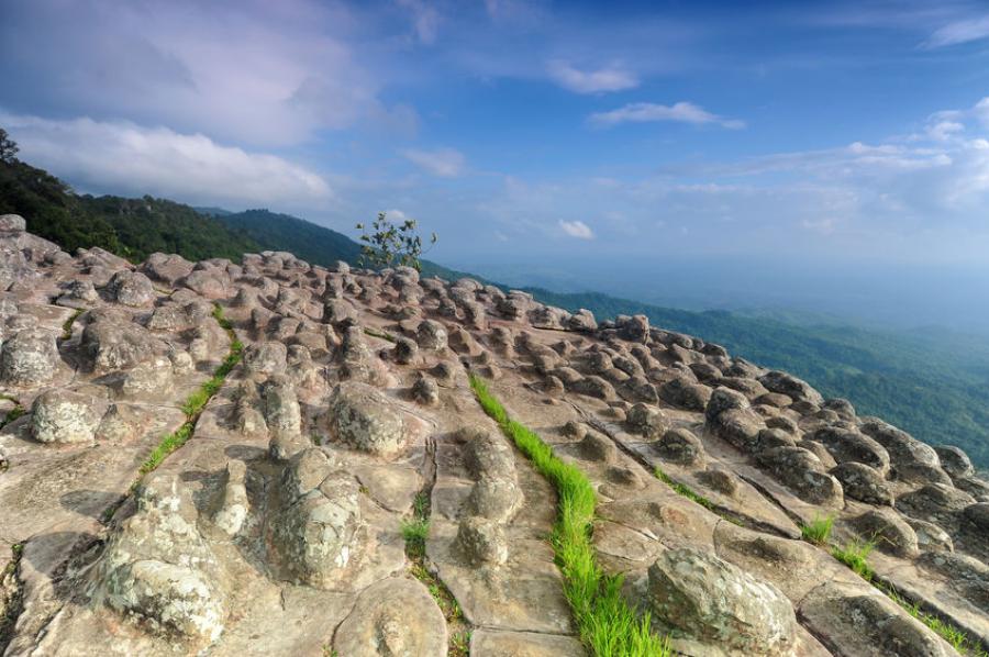
One of the best viewpoints in the country, known for it's strange rock formations, this series of viewpoints facing the valley to the west are accessible by a nearly 3 km long circular trail starting 3 km southeast from the headquarters. The Communist Party students used the rock formations in this area as shelter from air bombings.
The former Communist Party headquarters and their red victory flag are accessible along this circular trail. The headquarters is a museum nowadays, it exhibits weapons and medical instruments used by the communists.
The car park area of this viewpoint is spacious with many shopping/food vendors.
Lan Hin Taek Viewpoint
Situated less than half kilometer northwest from headquarters in Lan Hin Taek area, this viewpoint is famous for it's strange rock formations and the viewpoint over the landscape west from the national park.
Thap Boek Checkpoint and Viewpoint
A few good viewpoints in the park can be found near the Thap Boek checkpoint at the southeast side of the park. One of the viewpoints is only a few hundred meters from the checkpoint, while the more impressive one is 4.5 km further down the road east. Since the road follows a ridge, the view is good seen along most of the road.